| Map Images for Boat Launch and Beach |
2019-02-02 boat launch from road map -Adirondack Park Land Classification
 |
2019-02-02 Boat launch to Forrest L. Resource management Adirondack Park Land Classification with notes RT
 |
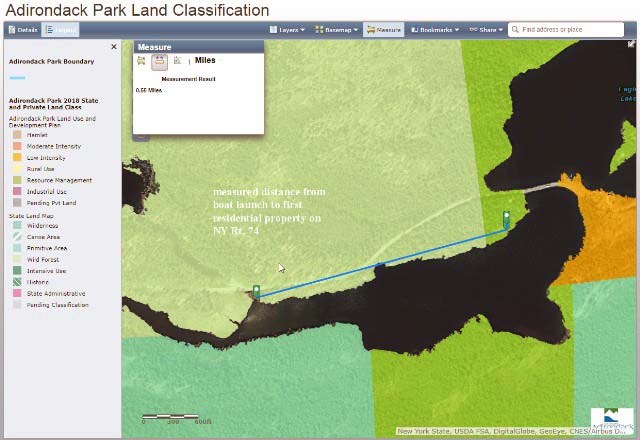
2019-02-02 Boat launch to Forrest L. Resource management Adirondack Park Land Classification
 |
2019-02-02 Boat launch to Forrest L. Resource management Adirondack Park Large Web view
 |
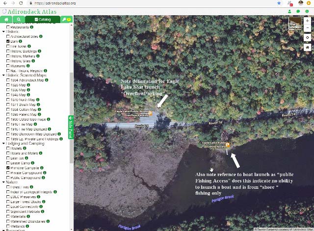
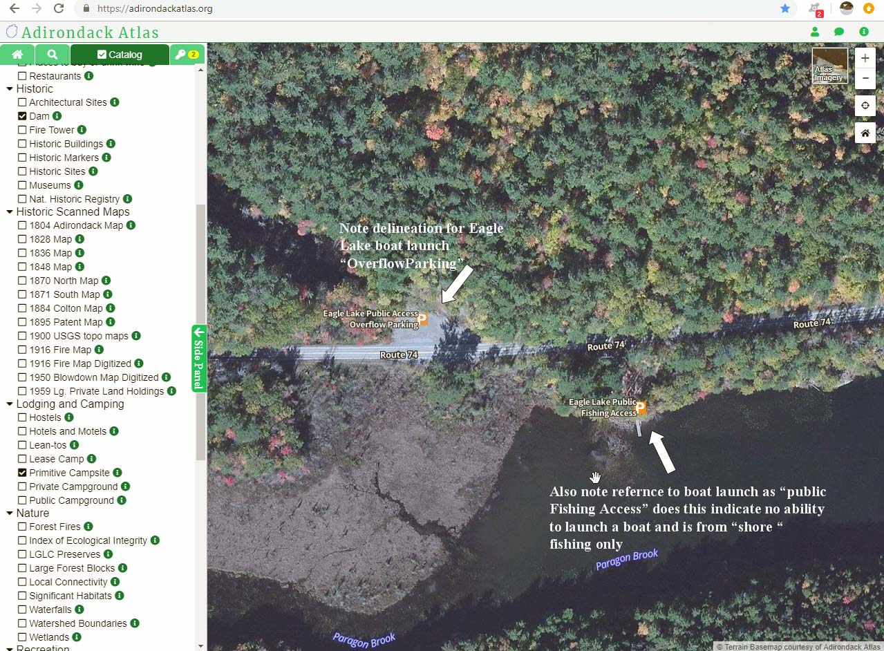
Delineation of overflow parking at bus turn around for EL boat launch note fishing access with notes RT Large Web view
 |
Delineation of overflow parking at bus turn around for EL boat launch note fishing access with notes RT
 |
Delineation of overflow parking at bus turn around for EL boat launch note fishing access
 |
| ArcGIS 2018 Proposed State Land Classifications |
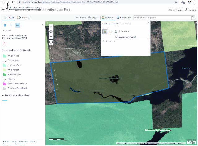
boat launch all acre measurement 10_12_22-ArcGIS - State Land Map of the Adirondack Park Large Web view
 |
boat launch all acre measurement 10_12_22-ArcGIS - State Land Map of the Adirondack Park
 |
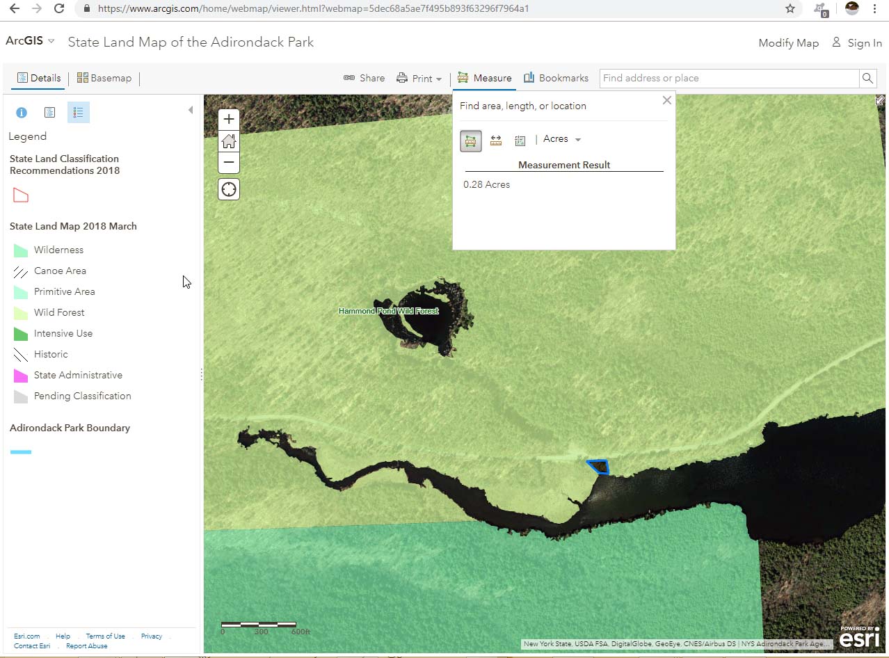
Boat launch site specific measure acre 10_14_07-ArcGIS - State Land Map of the Adirondack Park
 |
Boat launch site specific measure sq yards 10_14_07-ArcGIS - State Land Map of the Adirondack Park
 |
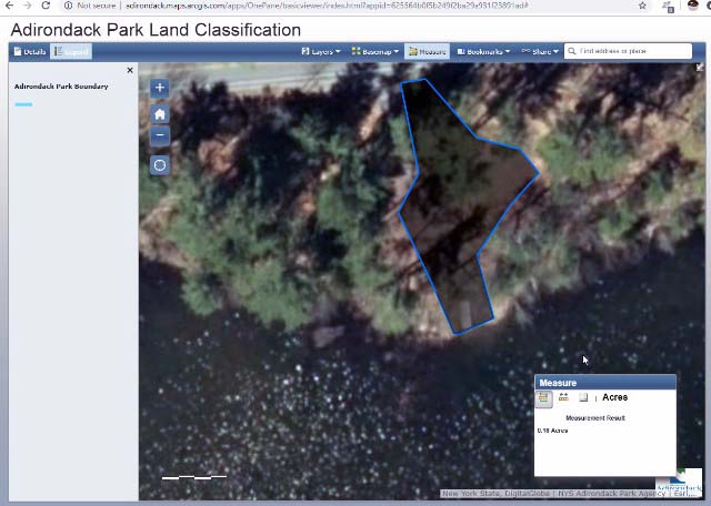
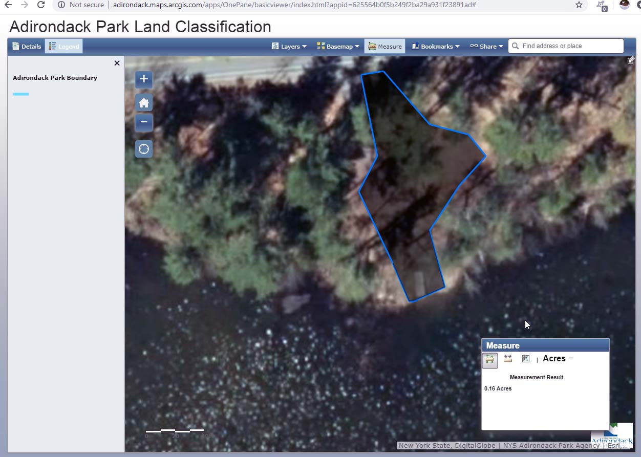
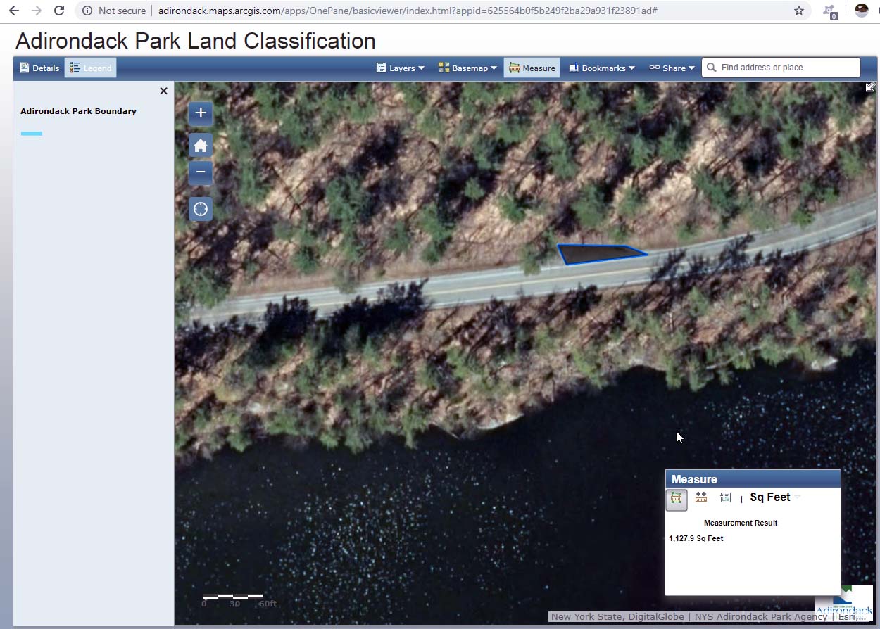
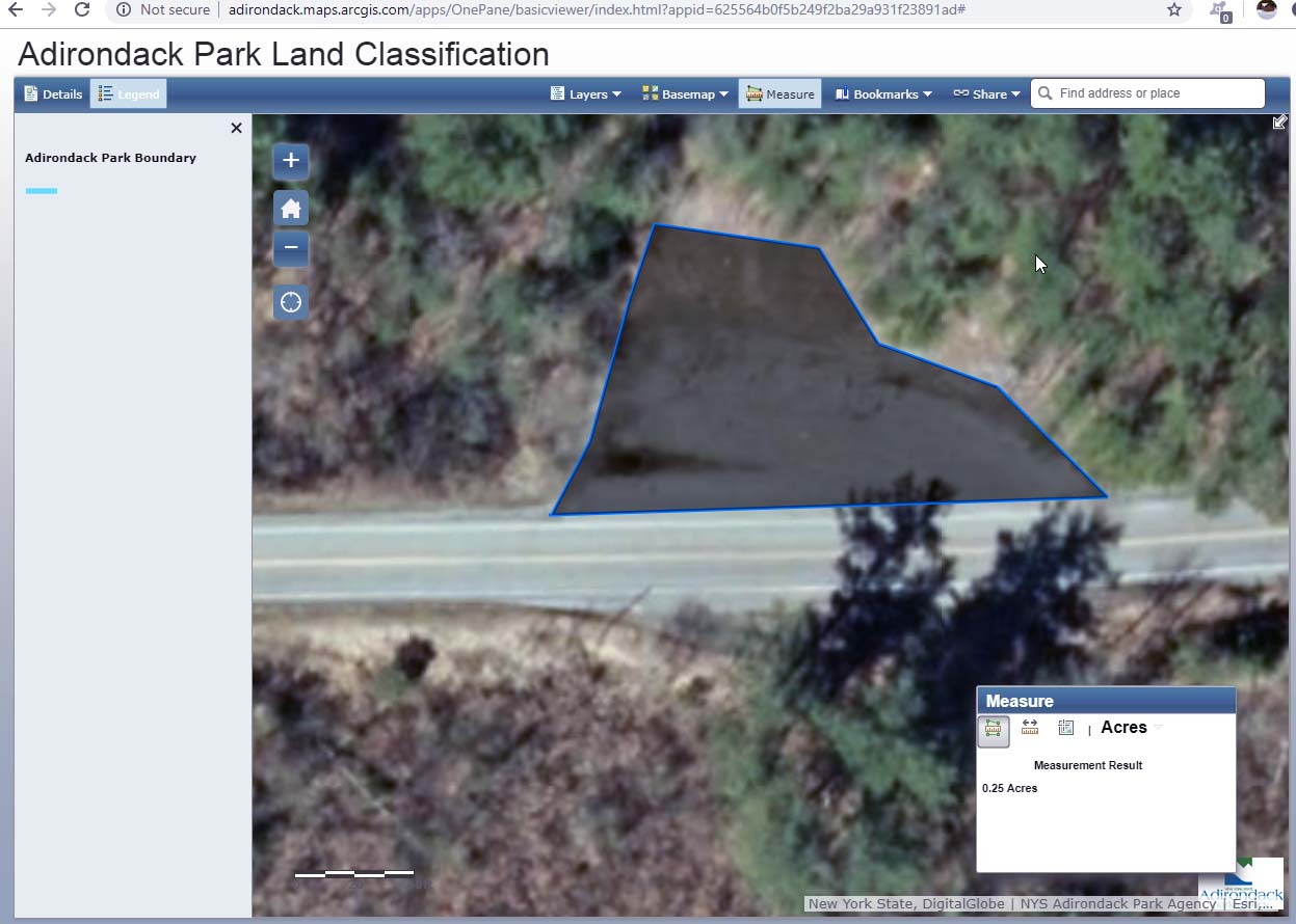
boat launch specific close up view of area mearure 20_20_18-Adirondack Park Land Classification Large Web view
 |
boat launch specific close up view of area mearure 20_20_18-Adirondack Park Land Classification
 |
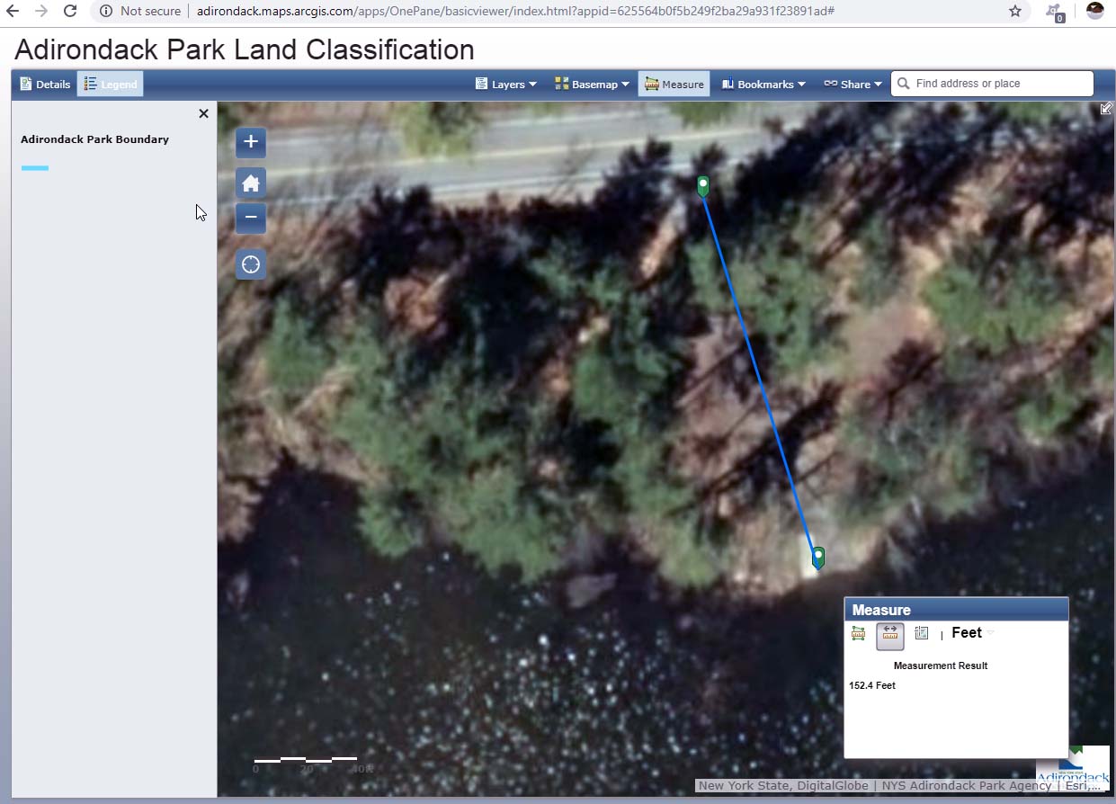
distance form road to water at boat launch 20_24_37-Adirondack Park Land Classification Large Web view
 |
distance form road to water at boat launch 20_24_37-Adirondack Park Land Classification
 |
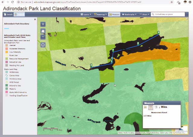
distance from boat launch to beach 20_46_40-Adirondack Park Land Classification Large Web view
 |
distance from boat launch to beach 20_46_40-Adirondack Park Land Classification
 |
distance from boat launch to diving rock parking 20_55_37-Adirondack Park Land Classification
 |
diving rock parking measure 13 20_59_52-Adirondack Park Land Classification
 |
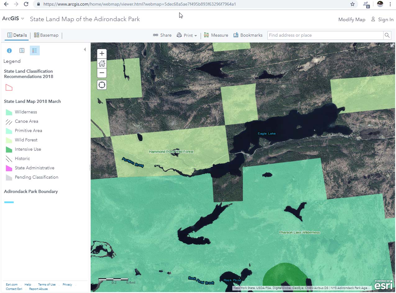
EL overall map 10_08_25-ArcGIS - State Land Map of the Adirondack Park
 |
Kayak paddling speed 21_21_21-FAQs
 |
School bus snow plow turn around across from boat launch area 20_22_49-Adirondack Park Land Classification
 |