|
|
Eagle Lake Property Owners, Inc. Celebrating 100 years of responsible lake stewardship in 2007. |


Curtain Transects Page Additional maps of Eagle Lake can also be found here. |
|
Summary-
|
- 2003 GPS Milfoil Survery Page- Essex County NY: Baseline study documenting the location and size of the largest and densest beds of Eurasian Watermilfoil in Eagle Lake (survey data, maps, and results).
- Turbidity Curtains Page- Information related to materials, costs, deployments, and accessories that can be used for creating a lake within a lake.
- Curtain Containment Leakage Testing Page- Proposals and materials for determining water exchange rates in curtain contained areas.
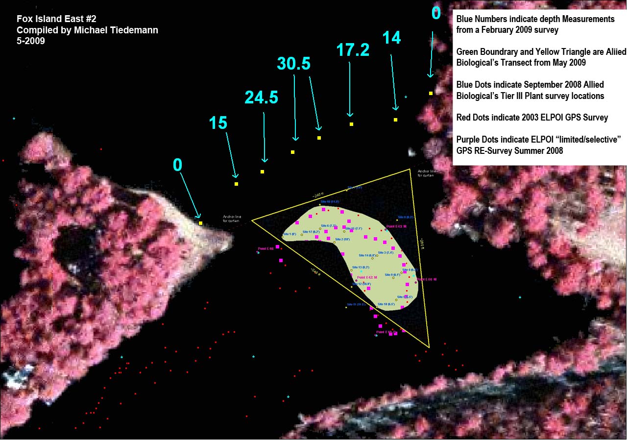
The transects below are overlay's that combine all of the data collected in the spring of 2009 showing how the transects compare, as ell as the location of milfoil in both 2003 (red dots), 2008 limited and location specific resurvey (purple dots), and blue dots indicate September 2008 Allied Biological Tier III Plant Survey rake toss locations (blue dots).
| Fox Island East | Fox Island East 2 |
 |
 |
| For a .pdf version of this map click here. | For a .pdf version of this map click here. |
| Ruck's Bay | Transect Survey Locations |
 |
|
| For a .pdf version of this map click here. | For a .pdf version of this map click here. |
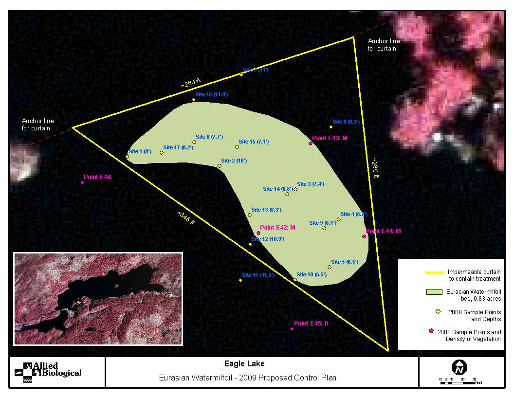
This survey was conducted by Allied Biological and produced the map below as their proposed curtain containment method on the east end of Fox Island. This was completed in an attempt to shrink both the cost and size of the treatment area to bring costs into an affordable range. This curtain was also intended to be anchored to the bottom instead of relying on shore anchor points.
| Fox Island East |
 |
| For a .pdf version of this map click here. |
This survey was conducted by the Adirondack Park Agency and produced the map and data table below. It included a resurvey of the February 2009 transect to prove the accuracy of the actual depths of 30' that were reported originally. Depths were confirmed to be accurate. It also looked at moving the February 2009 transects to differing locations in a hope of finding shallower crossing locations to reduce curtain expense. These alternative locations for putting curtains placed them over or through the middle of dense milfoil beds. These measurements were gathered by Ed Snezik (APA) and Tyler Smith (APIPP), with the assistance of Rolf Tiedemann (ELPOI Project Coordinator) with a depth sounder in a boat after the ice went out. Milfoil was not visible at this time due to early season and poor weather conditions on the date of survey.
|
||||||||

This data was the first true length and depth measurement gathered for this area. It was assumed in the discussion to select this area that depths would be in the 10-15 foot range and lengths in the 300-350 foot range on both sides of the island. The data was collected by referencing the 2003 Milfoil Baseline Study to indicate where the edges of the patches were located. Yellow points indicate measurement locations. Numbers in blue indicate actual depth (in feet) taken through the ice with a string and weight while the lake was at plus 4. Information gathered and compiled by Rolf and Michael Tiedemann.
Images of the survey being conducted are available for viewing through our photo page here.
| Fox Island West | Fox Island East |
 |
 |
| For a .pdf version of this map click here. | For a .pdf version of this map click here. |
| Fox Island Overview | Transect Survey Locations |
 |
|
| For a .pdf version of this map click here. | For a .pdf version of this map click here. |
Thank you for your support in helping to make ELPOI's goal of maintaining our lake and its surrounding shorelines a reality.
The ELPOI is a 501(c)(3) not for profit organization.
Site layout by Michael Tiedemann
Comments, corrections and additions are greatly appreciated!
Last Updated: February 16, 2020