|
|
Eagle Lake Property Owners, Inc. Celebrating 100 years of responsible lake stewardship in 2007. |


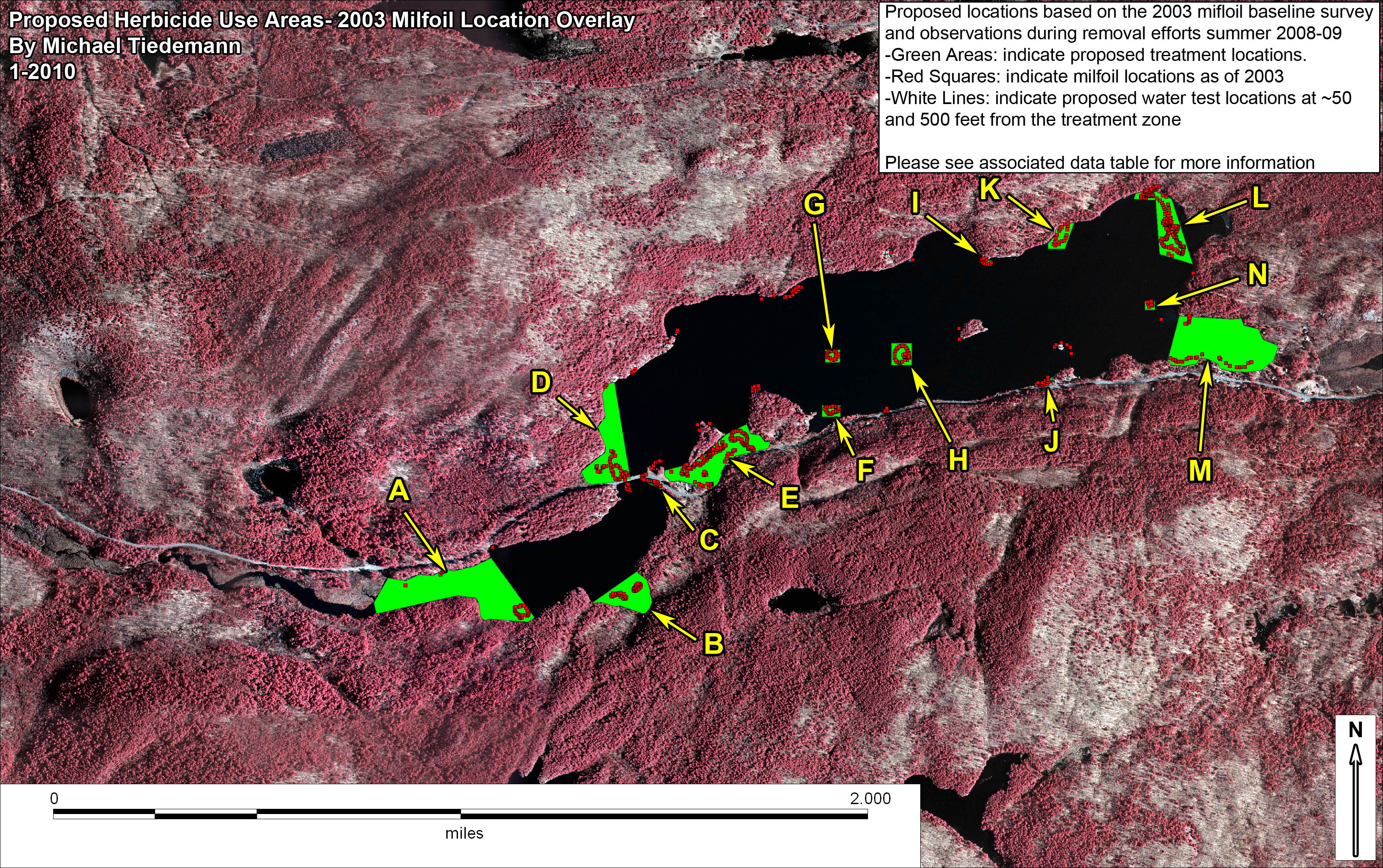
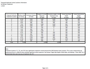
Proposed Herbicide Treatment Locations Page Additional maps were created to fulfill additional requirements involved with the NYS DEC herbicide use application documents. This included the addition of proposed water sampling locations ~50' and 500' outside the treatment area as well as the overlaying of 2003 milfoil location data on top of the curtain locations. No additional treatment locations were proposed however additional information on size was generated (see table bellow). Additional maps of Eagle Lake can also be found here. |
| Whole Lake View of Proposed Treatment Locations | Whole Lake View of Proposed Treatment Locations with 2003 Milfoil Data |
 |
 |
| For a .pdf version of this map click here. | For a .pdf version of this map click here. |
| Whole Lake View of Proposed Treatment Locations with Proposed Water Sampling Locations | Treatment Locations "E" and "I" with milfoil overlay |
 |
 |
| For a .pdf version of this map click here. | For a .pdf version of this map click here. |
| Data Table on Treatment Area Size/Dimensions and Shoreline/ Curtain Lengths | |
 |
|
| Link to Jacques "Eagle Lake Depths, Milfoil Beds, and Matting - Ti Bay 2009" as noted in document above. | |
2009 Treatment Sites Proposal
| East End | West End |
 |
 |
| For a .pdf version of this map click here. | For a .pdf version of this map click here. |
| Middle of the Lake | |
 |
|
| For a .pdf version of this map click here. | |
Thank you for your support in helping to make ELPOI's goal of maintaining our lake and its surrounding shorelines a reality.
The ELPOI is a 501(c)(3) not for profit organization.
Site layout by Michael Tiedemann
Comments, corrections and additions are greatly appreciated!
Last Updated: February 16, 2020